Overview
This post may contain affiliate links, which means we may receive a small commission, at no extra cost to you, if you make a purchase through our link.
This is a free way to support us and allows us to continue creating even more inspiring travel guides. Thank you for supporting the love we put into Coordinotes!
1. Seljalandsfoss and Gljúfrabúi
63° 36′ N, 19° 59′ W
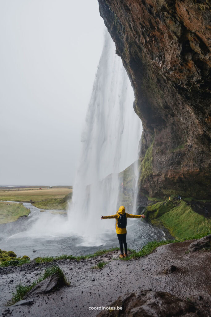
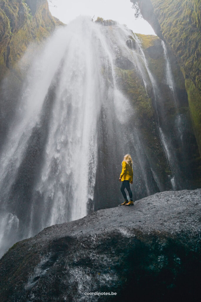
Seljalandsfoss is one of the most famous sights in Iceland. It is a beautiful waterfall with a height of 65 meters. You can take your time walking on a path and even go behind the waterfall! If you walk a little further than Seljalandsfoss, you find another beautiful waterfall called Gljúfrabúi. It’s like a secret waterfall inside a cave or narrow valley. When you go inside, it looks like the water is falling from the sky. Just be prepared to get sprayed by the force of the water!
Advertising
2. Hverir
65° 38′ N, 16° 48′ W
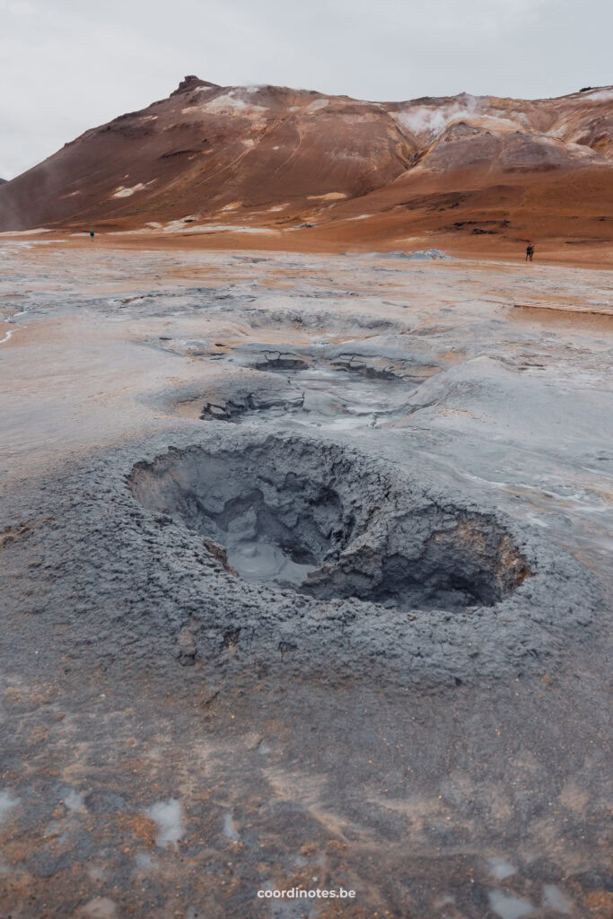
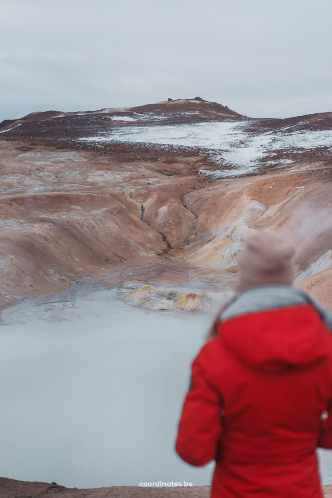
Hverir is a geothermal area and, just like almost everything in Iceland, this place has a volcanic origin. In the whole area, you find fascinating sulfur vapors, fumaroles and bubbling mud pots. When walking around at Hverir, you really get the feeling that you are walking on another planet, maybe Mars? It is arguably one of the most unique landscapes in Iceland.
You will notice that this place has a very bad smell, like rotten eggs. This is the typical smell of sulfur dioxide. Even though it smells awful, it makes the experience complete.
Hotels in Iceland
Discover the best places to sleep through our partners. Book your stay and enjoy their great deals!
Höfn
Reykholt
Bær
via Booking.com
3. Stokksnes
64° 14′ N, 14° 58′ W
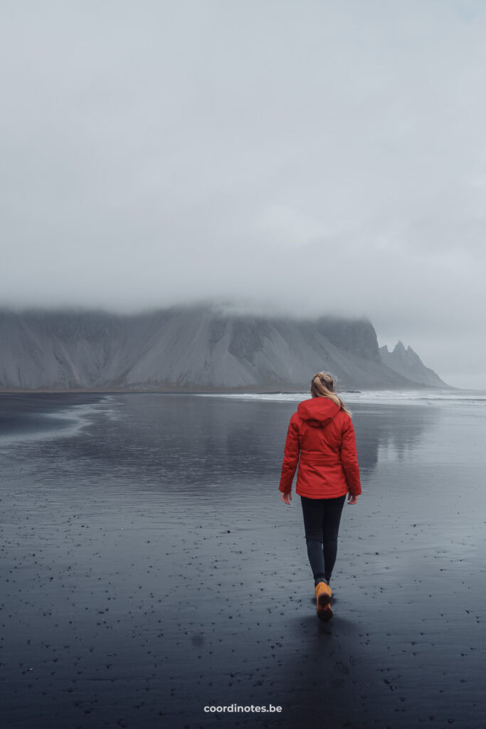
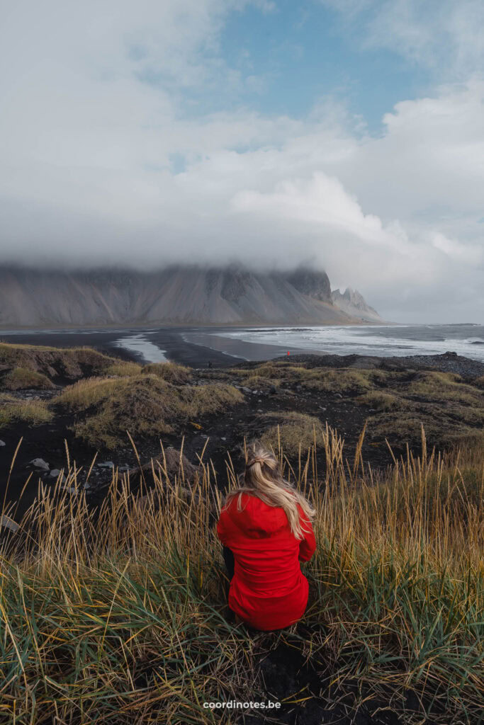
Stokksnes is a peninsula in southeast Iceland, where you find the dramatic Vestrahorn mountain. Together with Kirkjufell, it is probably the most photographed mountain in Iceland. Because of the contrast between the 454 meter high mountain and the black sand beach, there’s a mysterious atmosphere on this peninsula. Also the reflection of the mountain in the leftover water from the washed up waves, gives this place an extra dimension. If you’re lucky, you can even spot dozens of wild Icelandic horses around the beach.
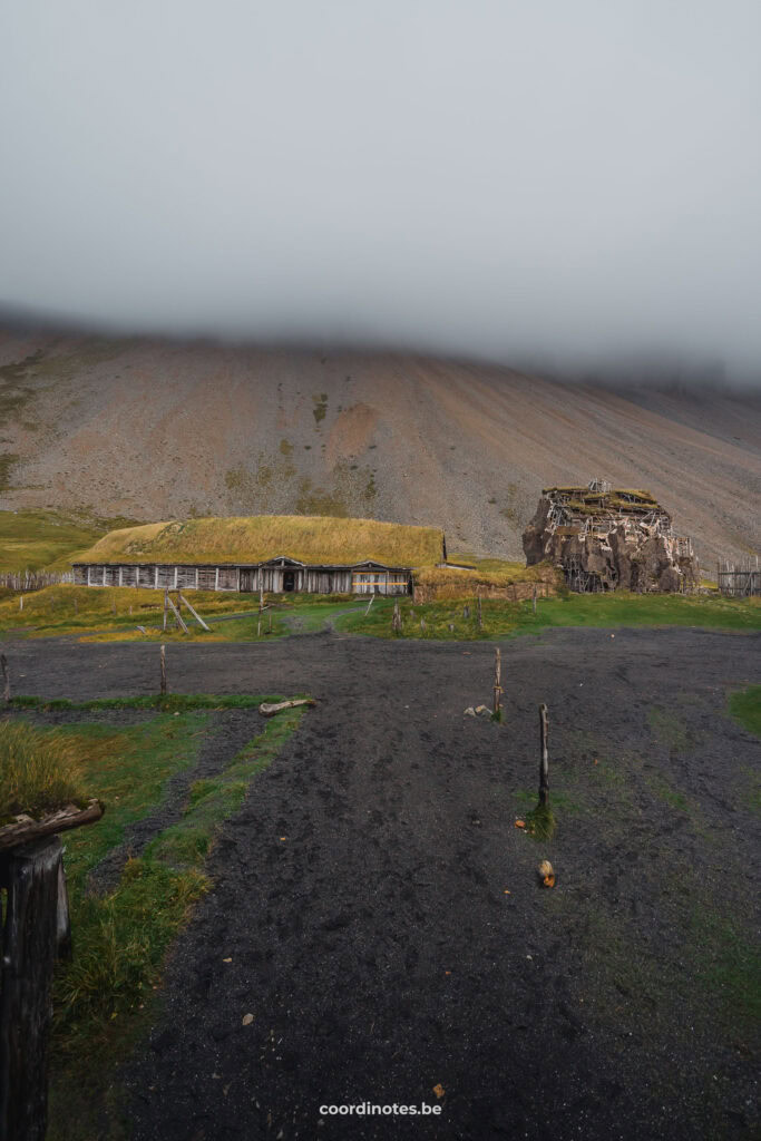
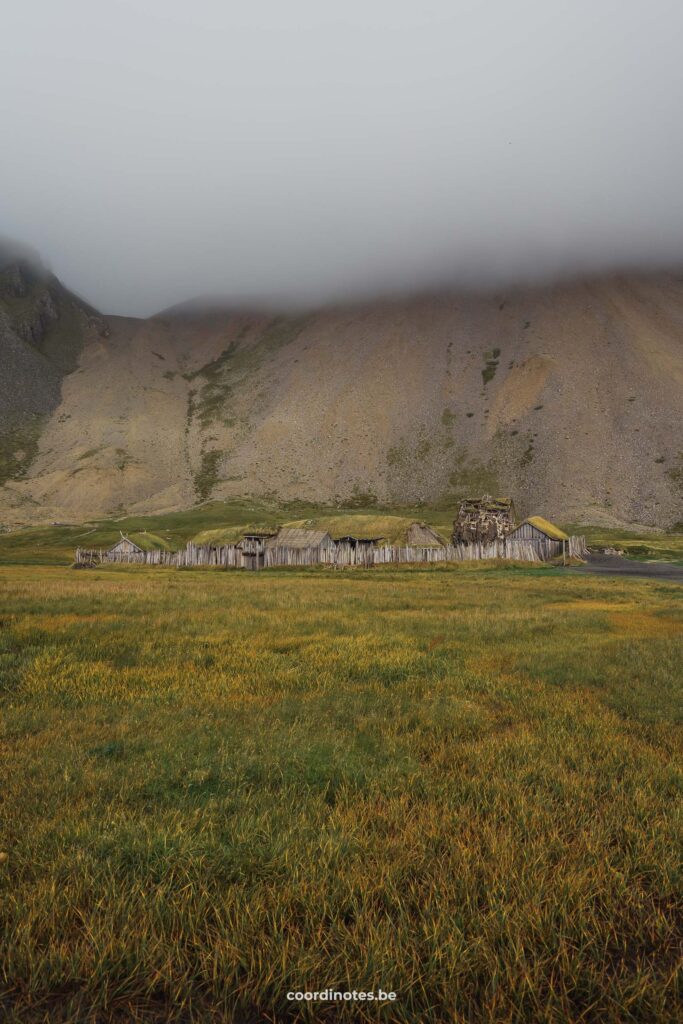
Besides the Vestrahorn, you also find the Viking Village Film Set. This replica Viking village was set up in 2010 as a movie prop. However, the Icelandic film was never shot due to funding issues. In 2018 it did made its debut in the movie Vikingr from Universal. Although it’s not a real viking village, it’s still fun to have a look and release your inner viking. You pass it anyway when you visit Stokksnes. You are even allowed to enter the houses.
Tip!
You have to pay an entrance fee of 800 ISK to access Stokksnes. If you stay at Camping Hofn, the entrance fee is included in the camping price.
Advertising
4. Kvernufoss
63° 31′ N, 19° 28′ W
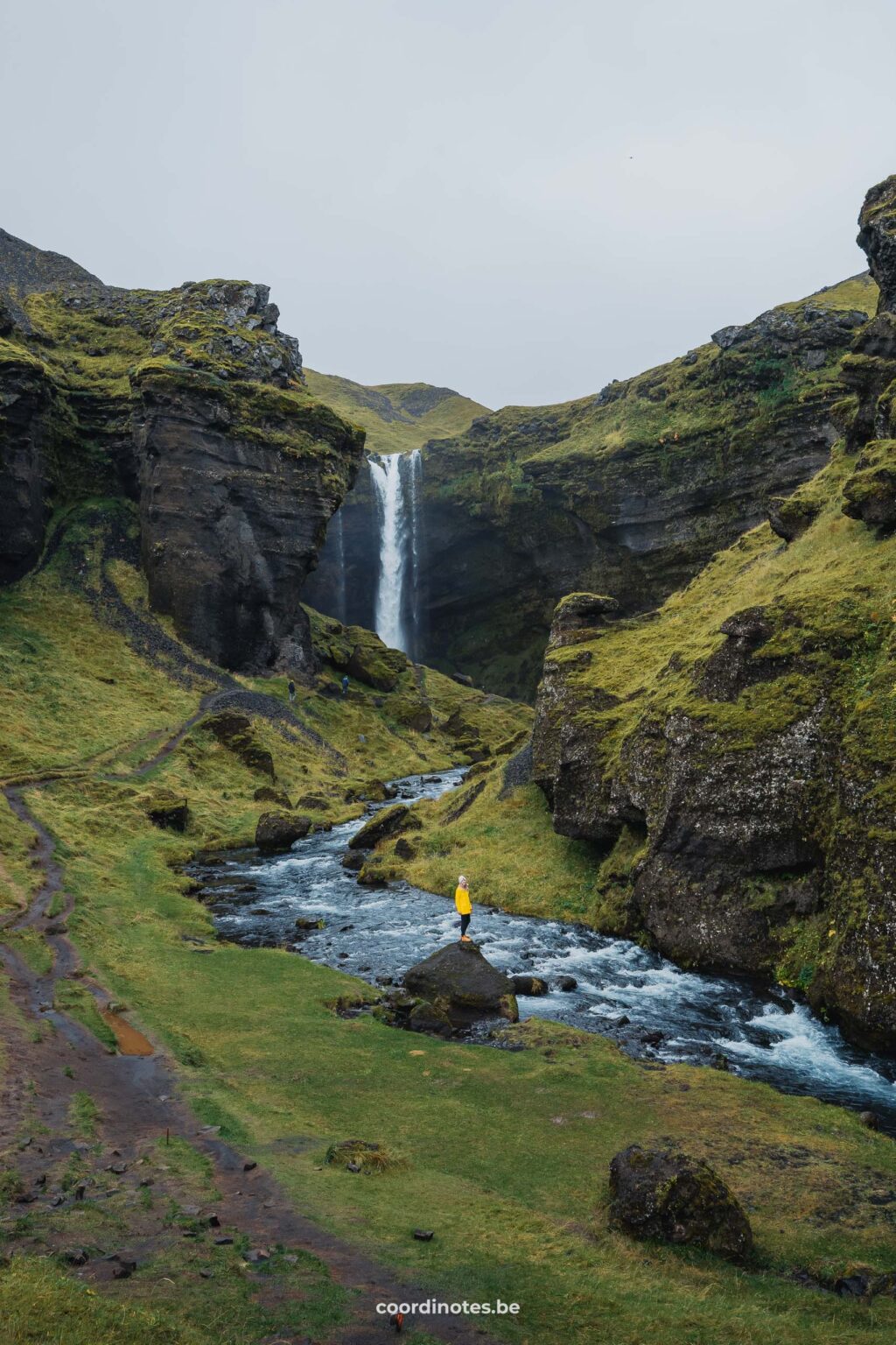
One of the lesser known, but one of our favorite, waterfalls in Iceland is the kvernufoss. This waterfall is located just around the corner of the more famous Skogafoss. So no reason not to visit, right?
The whole scenery is so stunning, like you’re walking around on the set of The Hobbit. And just like at Seljalandsfoss you can walk behind the waterfall, but prepare yourself again to be splashed by the spray of the waterfall.
Tip!
You have to pay an entrance fee of 800 ISK to access Stokksnes. If you stay at Camping Hofn, the entrance fee is included in the camping price.
More Iceland
5. Stuðlagil canyon
65° 09′ N, 15° 18′ W
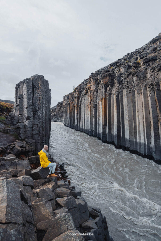
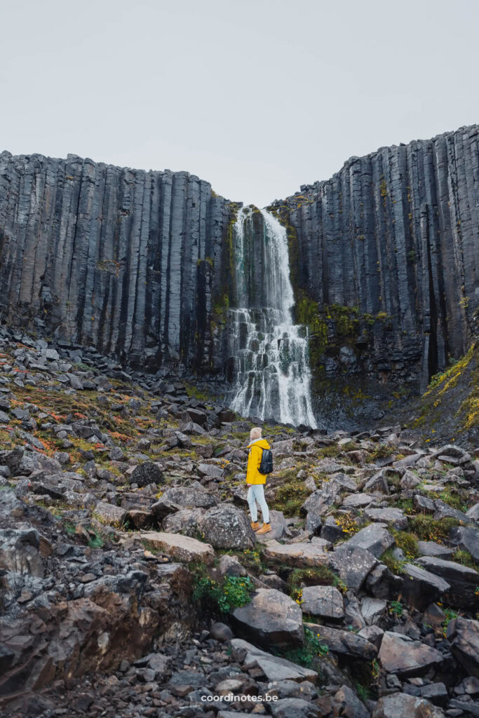
Stuðlagil canyon is a beautiful canyon that hardly anyone knew about until recently. It is formed by numerous gigantic basalt rock columns on both sides of the river. For a long time the canyon was hidden under the water. With the introduction of an hydroelectric plant in 2009 the water level decreased drastically, which made the canyon appear. In summer, from June until the second week of August this place is even more beautiful when the color of the river is turquoise green, showing a wonderful contrast with the gigantic grey basalt columns. In the third week of August, the hydroelectric reservoir is full and the overflow sends the dirty glacial water down the river, making the water brown and dirty. Although the color of the river changes over the seasons, the beautiful basalt columns formation remains very impressive to see.
Advertising
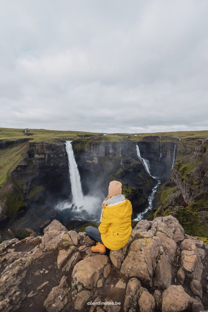
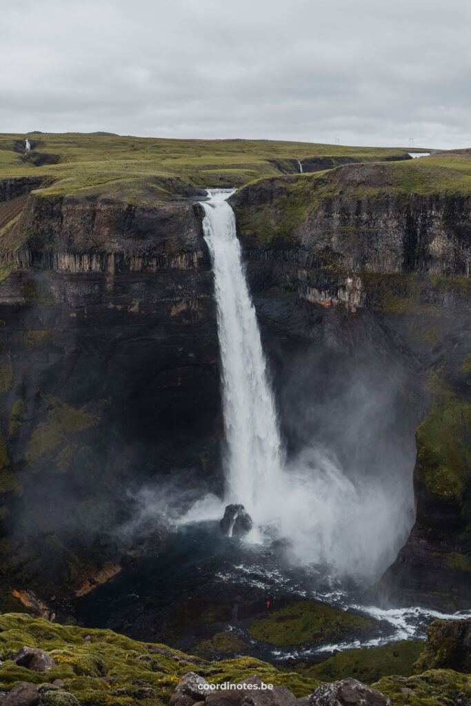
6. Haifoss
64° 12′ N, 19° 41′ W
Haifoss is, with its 128 meters, one of the highest waterfalls in Iceland. Next to Haifoss there’s another waterfall called Grannifoss. Both waterfalls are part of a phenomenal landscape and were one of the most impressive waterfalls we’ve seen on our route. You can drive to the top of the waterfall and enjoy the views from above, and if you like to you can hike to the bottom of the waterfalls as well.
Hotels in Iceland
Discover the best places to sleep through our partners. Book your stay and enjoy their great deals!
Höfn
Reykholt
Bær
via Booking.com
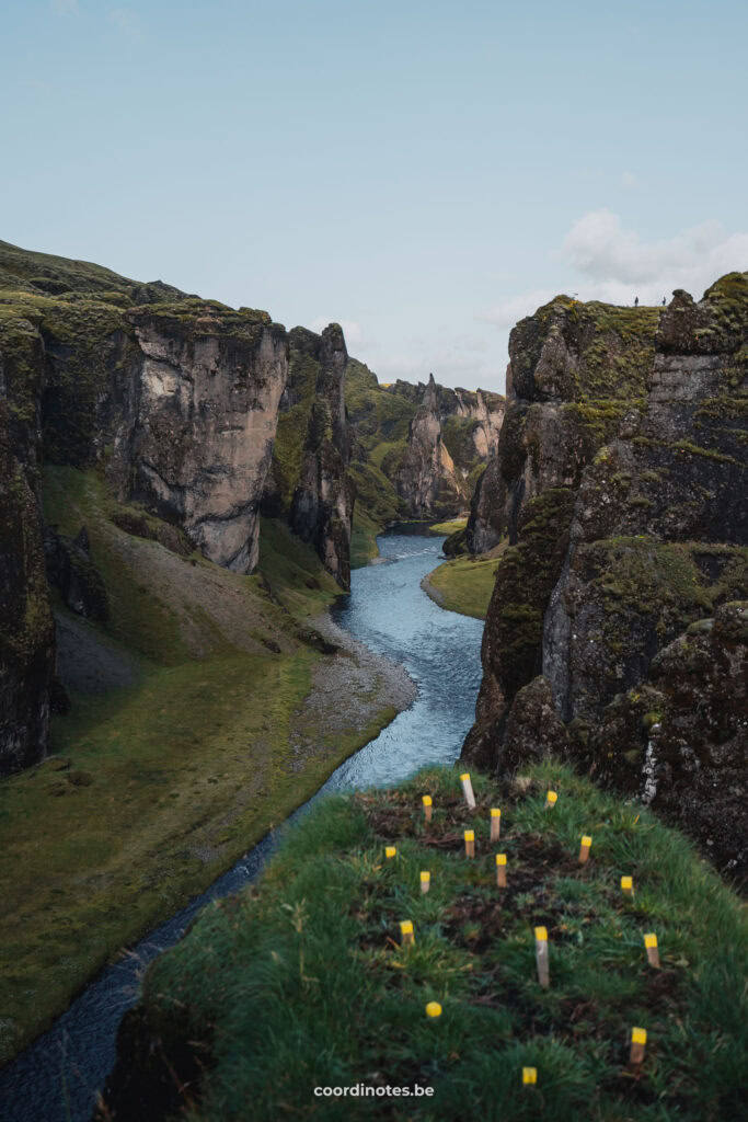
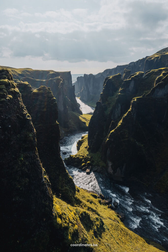
7. Fjaðrárgljúfur Canyon
63° 46' N, 18° 10' W
Fjaðrárgljúfur Canyon is a magical and maybe the most beautiful green canyon in Iceland. It is about 100m deep and 2km long. The canyon might be some 2 million years old and was formed by a forceful glacial river. Now the small Fjaðrá river runs like a snake between the steep walls of the canyon. Most of the ledges are fenced off and there’s a view platform by the waterfall because nature was too damaged because of the amount of visitors.
We heard that you can also walk inside the canyon (only in summer time) because the water levels of the river are usually not high. You might still need to wade the river a few times.
Advertising
8. Diamond beach
64° 02′ N, 16° 10′ W
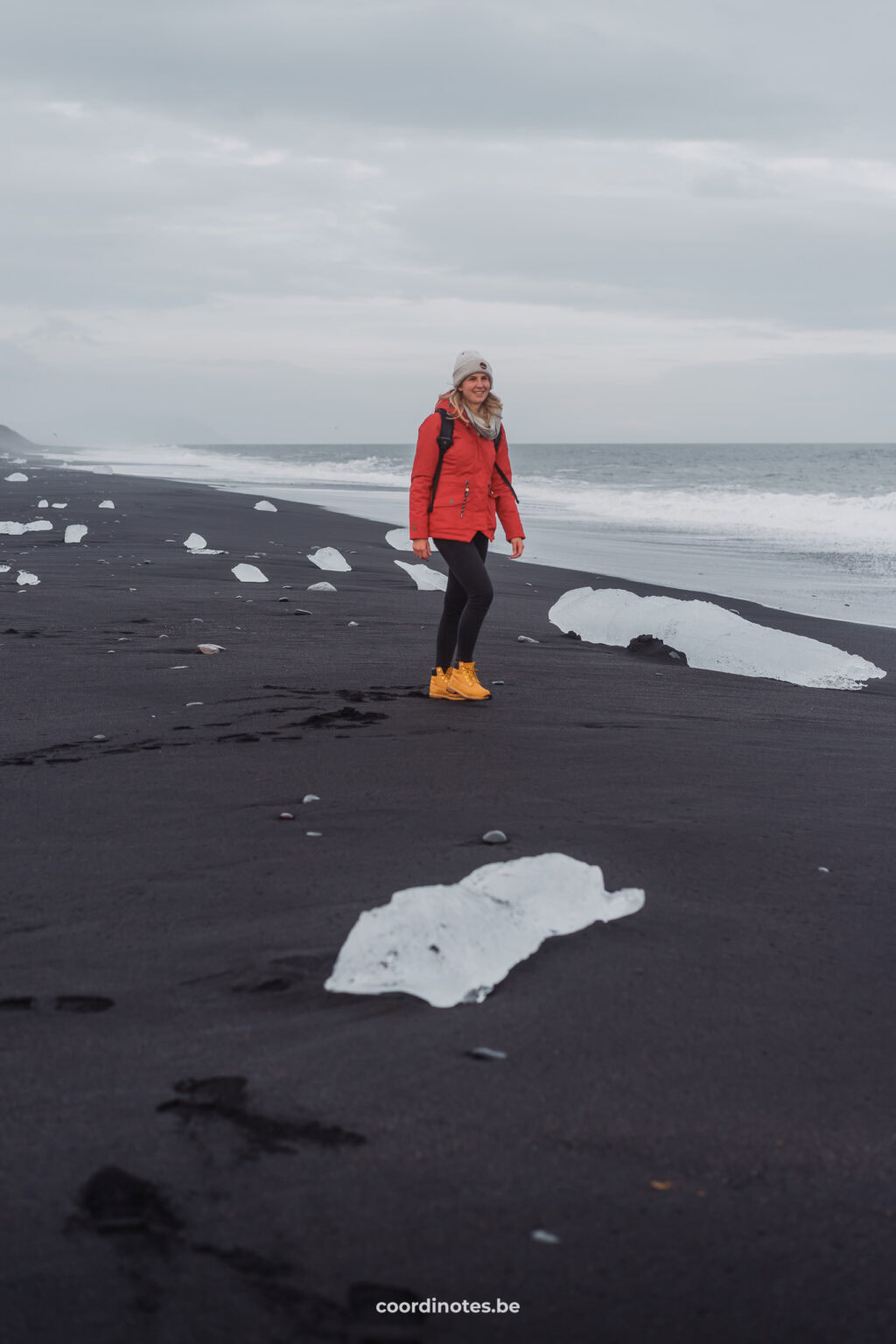
Diamond beach is one of those places where you find yourself in another world for a while. It is without a doubt one of the most beautiful places in Iceland. On this black volcanic beach numerous large and smaller ice blocks are scattered like diamonds over the sand. The contrast between the shimmering white and blue ice with the deep black of the sand makes it a truly magical place. Diamond beach is the result of glacial ice breaking off the glacier. This ice drifts over the Jökulsárlón glacier lagoon towards the sea. Here, the big chunks of ice crumble into thousands of smaller pieces and wash up on the beach. The amount of ice blocks you’ll find on the beach strongly depends on weather conditions and time of the year.
Diamond beach is also home to many seals, so if you look carefully you might spot a few of them. If you don’t see them here, chances are you see them in Jökulsárlón Glacier Lagoon. If you’re really lucky you also might see orcas, as this is one of the best places to see them from the shore.
Advertising
9. Jökulsárlón glacier lagoon
64° 04' N, 16° 12' W
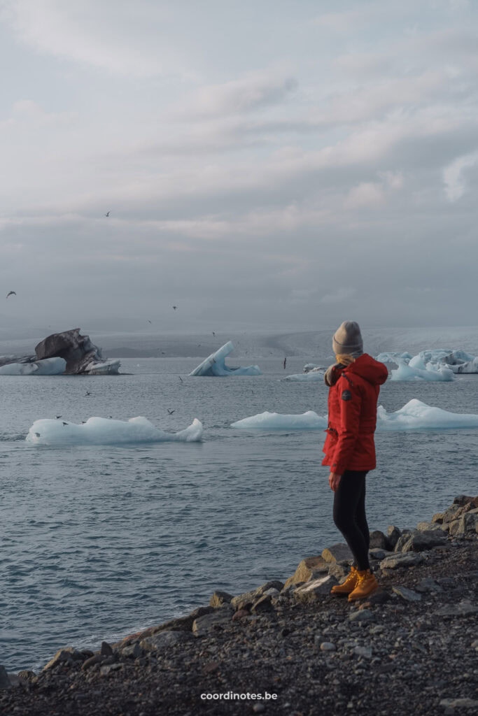
On the other side of the road from Diamond beach, you find the Jökulsárlón glacier lagoon. It is a huge glacial lake at the foot of the Breiðamerkurjökull glacier, a glacial tongue of Iceland’s biggest glacier Vatnajökull, located in Vatnajökull National Park. This lake is nearly 250m depth, making it Iceland’s deepest lake. All over this lake, gigantic ice blocks of glacial ice float around and slowly drift towards the sea, creating an ever-changing scenery. Therefor, this lake will never look the same every time you visit. Don’t forget to look out for these cute seals swimming around in the cold water of the lagoon.
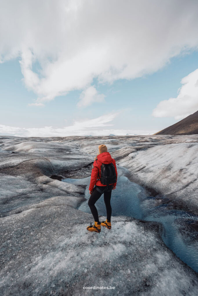
There’s a lot of activities you can do around the lake. You can go on a boat tour to see the lagoon, its icebergs and the seals from up close. Or you can join one of the kayak tours and even paddle yourself around on the lake. It is even possible to explore the Breiðamerkurjökull glacier itself during a guided glacier tour and sometimes even visit ice caves.
More Iceland
10. Sólheimasandur Plane Wreck
63° 28′ N, 19° 21′ W
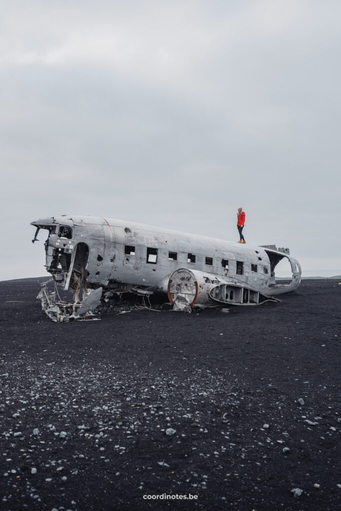
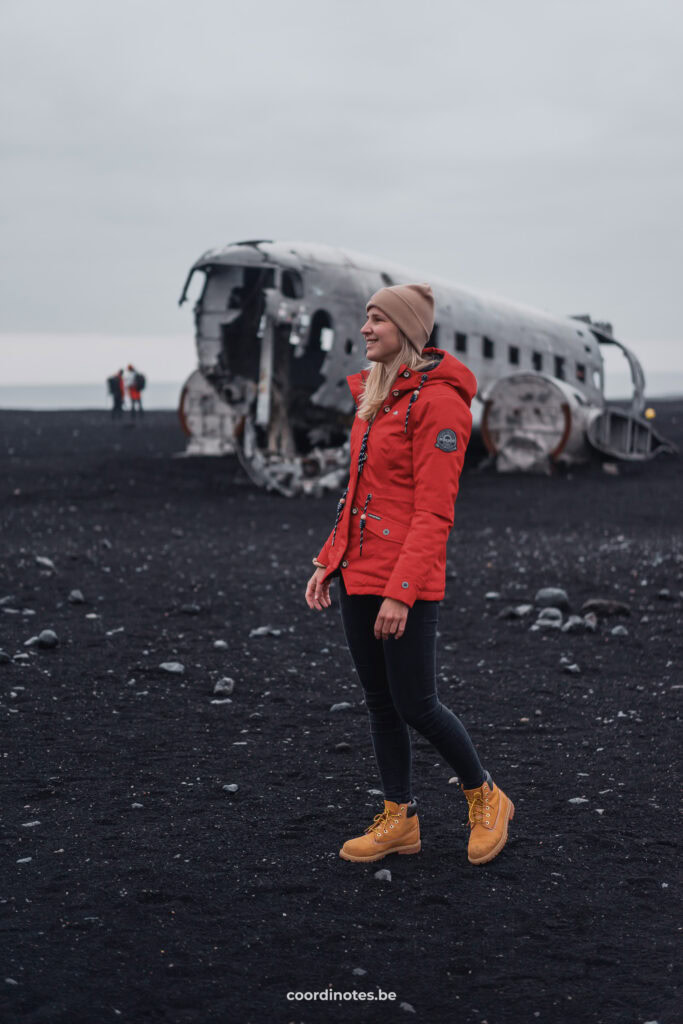
In 1973 a US Navy DC plane ran out of fuel and crashed on the black beach at Sólheimasandur. The most popular theory goes that the pilot switched to the wrong fuel tank during a storm, resulting in the crash of the plane. Luckily, everyone in the plane survived the crash.
The apocalyptic scenery of the crashed plane in such an abandoned, moon-like landscape is definitely worth a visit. The contrast between the remains of the man-made plane and the black sand of the beach makes it a spectacular setting. Today, big parts of the aircraft’s wings and the tail are gone. Rumours state that a local farmer sold those parts for cash.
To get to the plane wreck you have to walk 3,5 kilometers from the provided parking and it will take you around 45 minutes of walking one way. Taking into account the time you spend at the wreck, you should count on at least 2 to 2,5 hours for a visit to this intrigious place.
Flight deals
Fly to your destination at the best prices! Our partners offer many airlines on their platform so you can compare what is the best option for you.
11. Skogafoss
63° 28′ N, 19° 21′ W
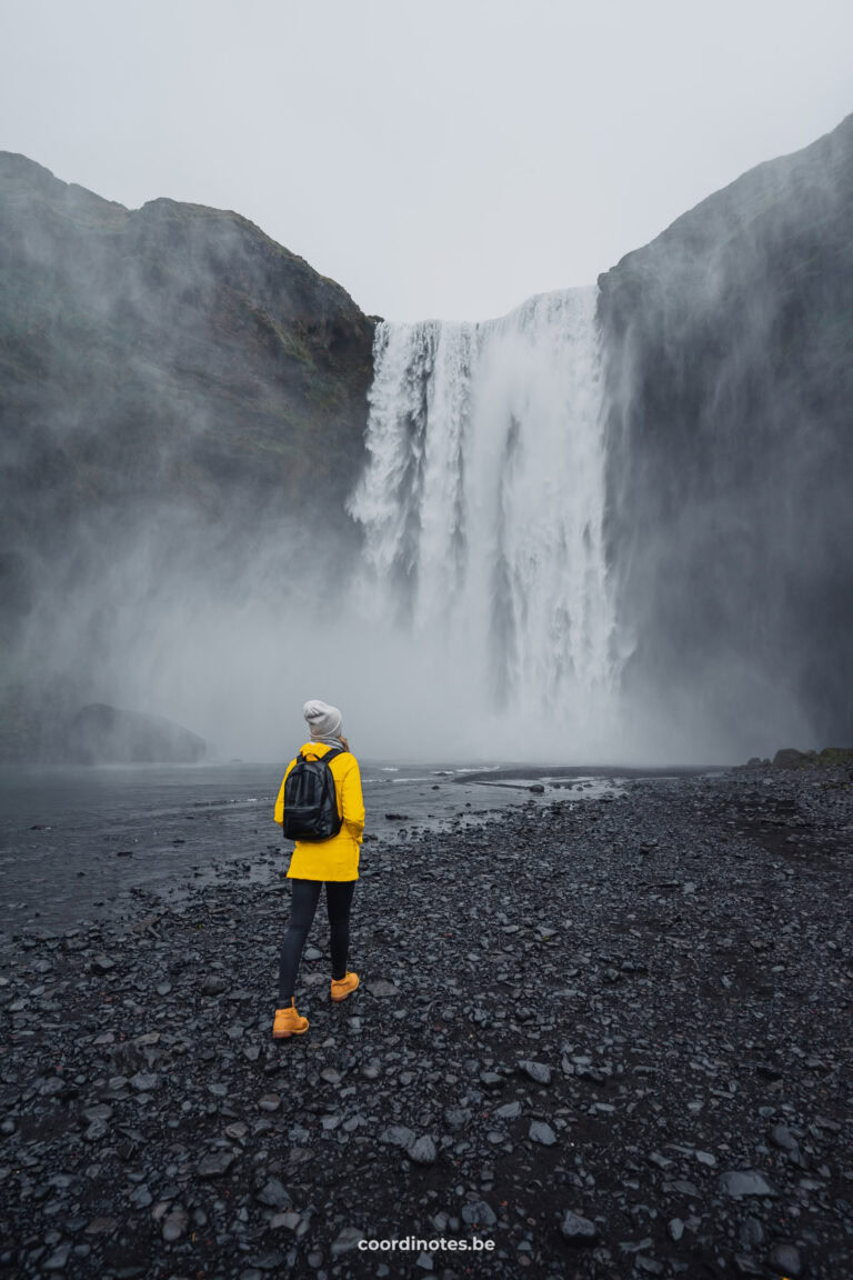
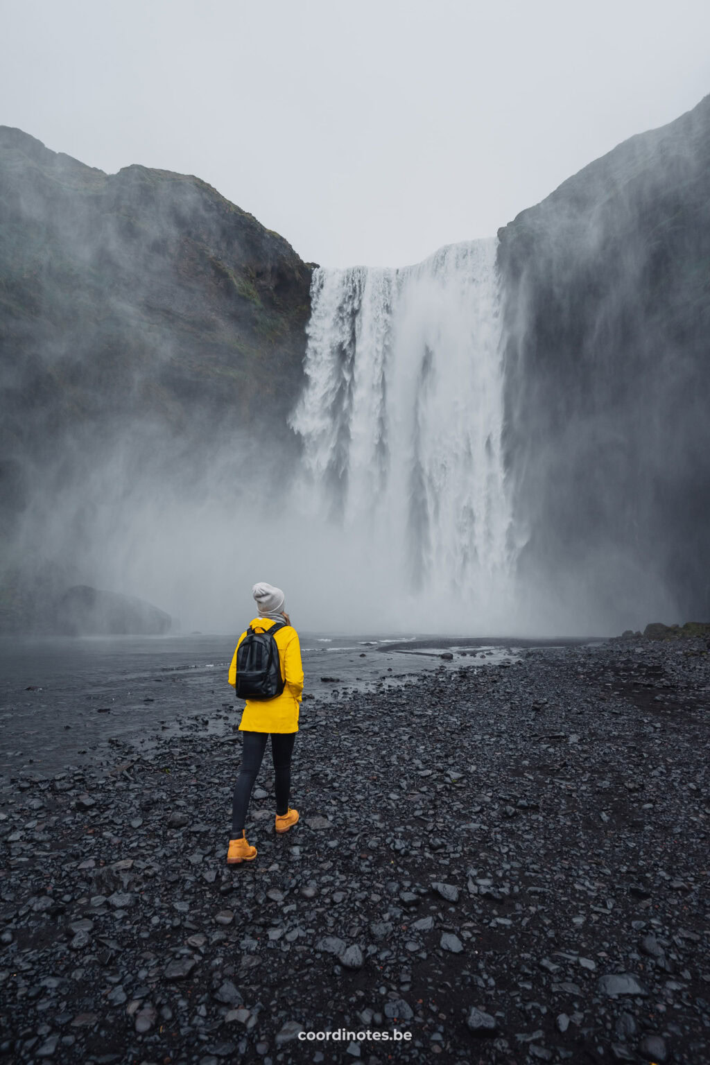
Skogafoss is one of the biggest and most famous waterfalls in Iceland. It is 25 meters wide and 60 meters high. Game of Thrones fans will recognize this place for sure. On the right side of Skogafoss there’s a stairway going up to a viewing platform. From here, a hiking trail starts that leads through the Fimmvörðuháls mountain pass.
Advertising
12. Dyrhólaey Viewpoint
63° 23′ N, 19° 07′ W
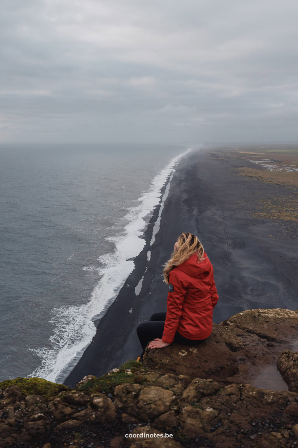
Dyrhólaey is the most southern point of Iceland. It is divided into a lower part and a higher part. At the higher part you find Dyrhólaey lighthouse. When walking around on the cliffs here, you can enjoy a fantastic view over the the beautiful Icelandic landscape with the Endless Black Beach, the Dyrhólaey archway and the impressive rock formations of Reynisdrangar. When looking inland, you can see the glaciers Eyjafjallajökull and Mýrdalsjökull.
This place is also known for its variety of birds, including the famous puffins (only during summer). During the spring/summer months Dyrhólaey has limited access by car because of nesting season, but it differs every season. The higher part can be closed somewhere between May and June for car traffic, but you can still access by foot during daytime.
Advertising
13. Reynisfjara Beach
63° 24′ N, 19° 03′ W
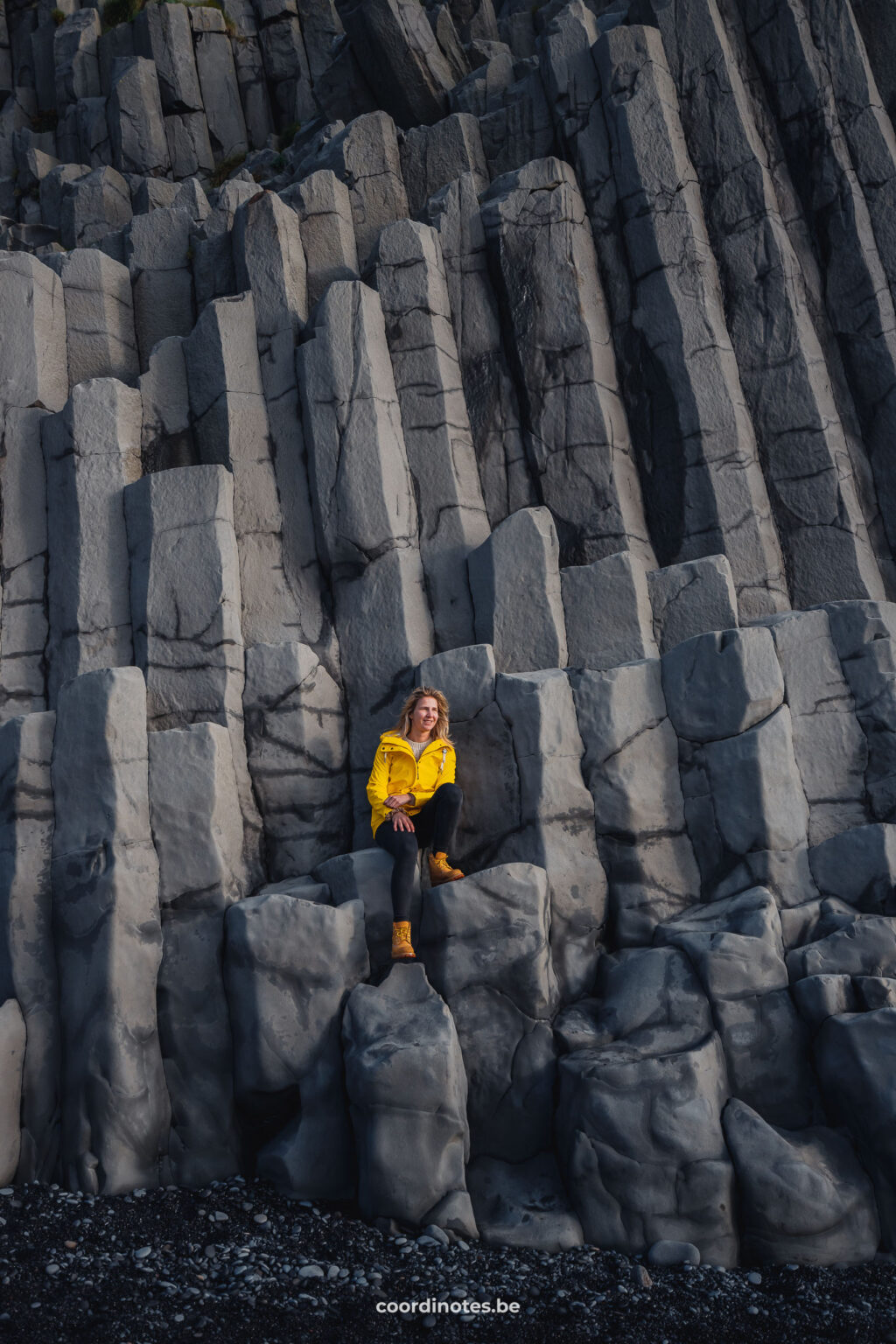
Reynisfjara Beach is a very famous black beach and is considered to be the most beautiful black sand beach in Iceland. It is mostly known for the gigantic basalt columns: the ‘Columnes Reynisfjara’. From here you also have an incredible view on rocky sea stacks of Reynisdrangar, the home of thousands of nesting seabirds.
Advertising
14. Myvatn Nature Baths
65° 37′ N, 16° 50′ W
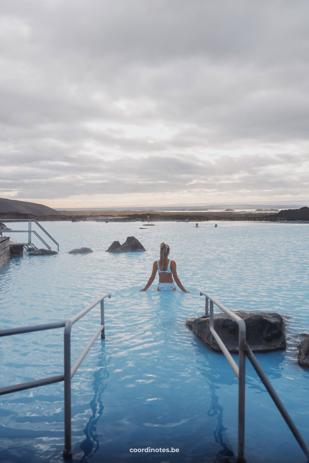
The Myvatn Nature baths are geothermally heated pools, filled with natural mineral water. They are also called Jarbodin. Here, you can soak in the magical soft blue water (which is also truly amazing for your skin) and enjoy the incredible views with a drink. Besides the pools, you can also relax in one of the hot spring steam baths. It’s the perfect place to empty your mind and to recover from all the traveling around this amazing country. This place is similar to the famous Blue Lagoon, but slightly less busy and expensive.
Flight deals
Fly to your destination at the best prices! Our partners offer many airlines on their platform so you can compare what is the best option for you.
15. Dettifoss
65° 48′ N, 16° 23′ W
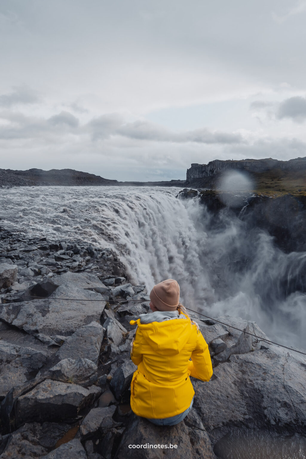
Dettifoss is said to be the most powerful waterfall in Europe. It is 44 meters high, 100 meters wide and displaces an average of 200m3 of water per second. You can visit the waterfall from both the east and the west side. To reach the east side you have to drive a gravel road (864) for a long time and to be honest we found this to be a very unpleasant road. It appears that the passability can vary, so inform yourself if you choose this road.
Reaching the west side appears to be more pleasant as this is a paved road (862). We didn’t visit the west side but we believe that you get a better view because from here you can see the front side of the waterfall. The westside is therefore the most visited.
Hotels in Iceland
Discover the best places to sleep through our partners. Book your stay and enjoy their great deals!
Höfn
Reykholt
Bær
via Booking.com
16. Kirkjufell
64° 65′ N, 23° 18′ W
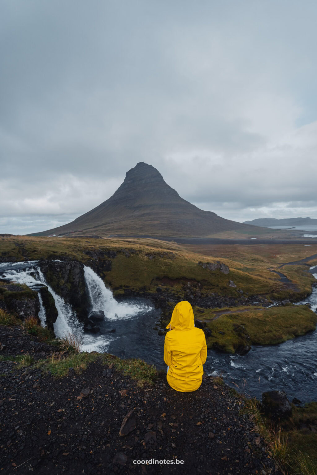
On Snæfellsnes Peninsula, you find this stunning mountain called Kirkjufell. Its name means “Church Mountain” due to its remarkable shape, that looks like a church. Kirkjufell is known for its unique beauty and has become an iconic landmark in Iceland. It is said that it is the most photographed place in Iceland. The mountain is surrounded by a beautiful landscape, including the nearby waterfall called Kirkjufellsfoss, creating this very photogenic setting. It is definitely worth its place in this list of most beautiful places in Iceland.
Advertising
17. Þingvellir National park
64° 65′ N, 23° 18′ W
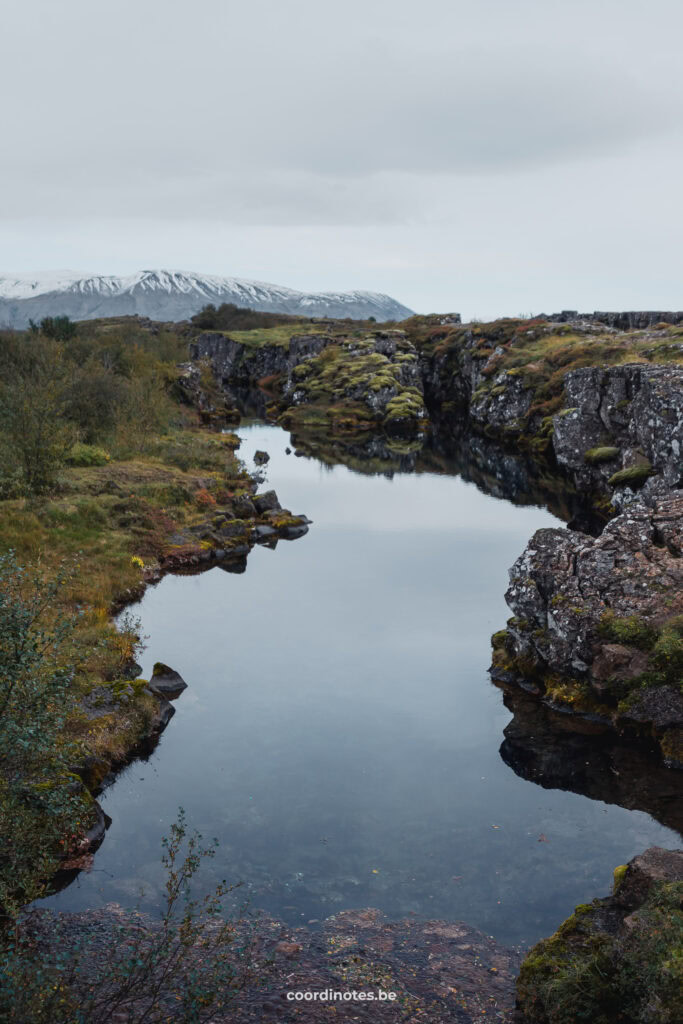
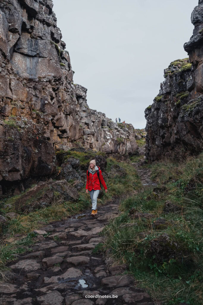
Þingvellir or Thingvellir National park is part of the famous Golden Circle in Iceland. In this national park, you can witness Iceland’s rough geological processes with your own eyes. Iceland is located on both the North American tectonic plate and the Eurasian tectonic plate. In Þingvellir National park, you can actually see the split between those two tectonic plates. Iceland is the only place in the world where the rift is above sea-level and thus can be seen on land.
Besides geology, Þingvellir is also historically very important to Iceland, which is why it became a National Park. Since 2004, it is listed as a UNESCO world heritage site.
You can also go snorkeling or diving in the Silfra fissure in this national park. It is the only place in the world where you can dive between two continents. It is ranked as one of the top 10 best diving sites in the world because of the vivid colors and extremely clear water in this place.
Win-Win for everyone
Did you know that, if you buy or book something through our links, we receive a small commission?
However, you still pay the same and therefore have no extra costs! So a win-win for everyone. This way, we can continue to add even more travel inspiration and tips to this blog for your next adventure. Thanks a lot!
Thank you for visiting our blog
We hope you find our free travel guides and tips useful. If you want, you can support us virtually by ‘buying us a coffee‘.
Every contribution, no matter how small, is greatly appreciated and will help us continue to share our passion with you and grow this blog.
Win-Win for everyone
Did you know that, if you buy or book something through our links, we receive a small commission?
However, you still pay the same and therefore have no extra costs! So a win-win for everyone. This way, we can continue to add even more travel inspiration and tips to this blog for your next adventure. Thanks a lot!


