
This post may contain affiliate links, which means we may receive a small commission, at no extra cost to you, if you make a purchase through our link.
This is a free way to support us and allows us to continue creating even more inspiring travel guides. Thank you for supporting the love we put into Coordinotes!
Preikestolen or Pulpit Rock is one of the most iconic natural landmarks in Norway. It is a huge cliff that rises 604 meters above the Lysefjord. This cliff is over 10.000 years old and one of the best places to visit in Southern Norway.
Also, the hike to this amazing scenery is breathtaking and will reward you with the most incredible views over the Lysefjord. The hike to Preikestolen is around 4km, so the total hike is 8 km. You will have to ascend a total of 500 meters to reach the top.


Stegastein viewpoint is a viewing platform with a panoramic view 650 meters above Aurlandsfjord. It is part of the National Tourist Road, from Aurland to Lærdal, also known as “The snow road”.
The wooden platform protrudes 30 meters from the mountainside and it is one of the most photographed viewpoints in the region. And we can easily see why. The panoramic view over the fjord and the surrounding mountains is just breathtaking.
The easiest way to reach the viewpoint is by car. In summer you can drive to Stegastein from both Flåm and Aurland. During winter the road is closed just above Stegastein, so you can only drive up from Flåm.


Bondusvatnet glacier lake is one of the most popular hikes in the Hardanger region. The hike is short, not demanding and you can do it all year round. The colors of the lake, the unique landscape, and the glacier in the background make Bondhusdalen one of the most beautiful valleys in Norway.
The hike is an out & back trail of in total 4,5 km over a gravel road. It will take you about 45 minutes to reach the lake, so the total hike is around 90 minutes. If you want to go all the way to the glacier, you’ll have to walk 30 minutes to reach the glacier. For the parking lot, you have to pay a fee of 100 NOK.


Trolltunga (literally translated as troll tongue) is without a doubt one of the most scenic and most famous rock formations in Norway. It is a spectacular cliff hovering 700 meters above Ringedalsvatnet Lake.
To reach this cliff you will have to take a long and demanding hike, but you will be rewarded with some breathtaking views.
We recommend that you go as early as possible, or even spend the night at the Trolltunga. Since this is one of the most famous places to visit in Norway, it can get incredibly busy here. We have even heard that it sometimes takes hours to queue for a photo.

Discover the best places to stay in Odda (near Trolltunga) and enjoy a comfortable trip!
The Geirangerfjord is the most famous fjord and one of the most beautiful places in Norway. It is a 15-kilometer-long arm of the Storfjord and a must-visit during a Southern Norway road trip.
The fjord has several waterfalls and is one of Norway’s most visited tourist attractions. Since 2005 the fjord has been listed as UNESCO World Heritage.
There is so much to see and to do in this region:
On top of that Geiranger has the Sustainable Destination certificate, which means this destinations systematically try to counteract the negative impact of tourism. Bonus points!


Vøringsfossen is not only one of the most beautiful waterfalls in Norway but also one of the highest waterfalls in Europe. It is 182 meters high in total, with a free fall of 145 meters. What makes this waterfall so beautiful is that it is located in a steep, fairytale-like gorge: the Måbødalen valley. It is located next to the famous Hardanger tourist road RV7 and there are multiple viewing options.

Rampestreken viewpoint provides a fantastic view over the valley of Andalsnes in Southern Norway. You can either hike up to this viewpoint or you can make it yourself easier and take the cable car.
You pass this viewpoint during the Romsdalseggen hike, one of the most beautiful hikes in Norway. But you don’t have to do the full hike to enjoy this beautiful view.
The complete Romsdalseggen hike is 10,3 km. If you hike it in the direction of Andalsnes, you will come across the viewpoint on your final descent.
We chose to take the cable car up and walk back down.
The hike to Rampestreken viewpoint is about 2 km one way and 520 meters of elevation (steep and tough).
Single: 370 NOK
Return: 550 NOK

Jotunheimen National Park is a national park in Southern Norway. It is also called the land of the giants as you will find over 250 mountains of almost 2000 meters high in this park. It is one of the most popular areas of the country for mountain climbing, hiking, and other outdoor activities and is known to have some of the best hikes in Norway.
14,3 km
743 m
1100 m
6 to 8 hours
A to B hike
Easy - Moderate - Difficult - Expert
The Besseggen Ridge hike is the most beautiful hike in Jotunheimen. It is also one of the most famous hikes and mountain ridges in Norway. During the hike, you get a spectacular view of Gjende and Bessvatnet separated by just this small ridge that you will walk on.

12,6 km
718 m
718 m
4 to 5 hours
Loop
Easy - Moderate - Difficult - Expert
The Knutshøe is a mountain in Jotunheimen Park on the other side of the Gjende Lake, where you find the Besseggen hike. It is a 1517-meter-high peak from where you have marvelous views over the surrounding peaks and lakes. The Knutshøe is often referred to as the little brother of the Besseggen Ridge.

With a free fall of 275 meters, Vettisfossen is Norway’s largest protected/unregulated waterfall and we have to admit that the waterfall is quite powerful. It is located in a protected area in Utladal, near Øvre Årda.
When hiking to the Vettisfossen waterfall, you will not only be rewarded with this powerful beauty, but you can also enjoy many other beautiful waterfalls along the way: Hjellefossen, Avdalsfossen, and many other little waterfalls spread throughout the valley.

If you’re exploring the Nordfjord area, Stryn is a great place to base yourself. It has that classic mix of fjords, mountains, and glaciers all in one spot. The town is small but has what you need, and it’s a good starting point for checking out places like the Briksdalsbreen glacier and the beautiful Lovatnet lake (more about these places later).

There’s a lot to do if you enjoy the outdoors. You can go hiking, take a glacier tour, or even fit in some skiing, depending on the time of year. One of the best views of Stryn is from above, where you can see the river winding through the landscape.
Jostedalsbreen is the largest glacier in mainland Europe. It covers almost half of the Jostedalsbreen National Park and is definitely one of the most unique places to visit in Norway.
The Jostedalsbreen has several side arms, such as the Nigardsbreen and Tunsbergdalsbreen, the Briksdalsbreen, the Bøyabreen, the Kjenndalsbreen and Austerdalsbreen.
Boyabreen is the most easily accessible one. You will have a beautiful view on the glacial sidearm from the parking lot.


In front of this sidearm is a small glacial lake called Briksdalsbrevatnet. At this lake, you find hundreds of little, super clear pieces of ice. To get close to Briksdalsbreen, you have to walk for about 2,5 km. Or you can take a small shuttle car, but they are not electrical. In our opinion, this contributes to the disappearance of this impressive natural phenomenon so we advise you to go for a walk.


Another easily accessible side arm is the Nigardsbreen but you can get closer to the glacier than at Boyabreen. The hike to Nigardsbreen is an out & back trail of in total around 4 km. After about one hour you will reach the glacier, so it’ll take you 2 hours to get back to the starting point. The walk has no steep ascents but the path is very uneven and slippery because there are big rocks you’ll have to cross. In the summer you can skip a part of the walk by taking a boat.


Some people say Lovatnet is the most beautiful lake in southern Norway, and honestly, it’s hard to argue with that. The water has this really clear green color from the nearby glaciers, and the whole area is super quiet and relaxed.
You can rent a little boat, go for a short walk, or just sit by the edge and take it all in. There’s a small café by the lake if you want a coffee or a bite to eat. It’s not too crowded either, which is a nice bonus.

Mardalsfossen is a super impressive waterfall in the Møre og Romsdal region in Southern Norway. With a height of 655 meters and a free fall of 297 meters, it is the highest waterfall in Northern Europe. This waterfall is kind of a ‘special one’ because you can only see it 2 months a year: from June 20 to August 20. This is due to the construction of the Mardalsfossen dam.
For the remaining 10 months of the year, the water is diverted to generate electricity. It makes this waterfall even more unique. Yet another reason to visit if you are in Norway at the right time. To get to this waterfall, you have to do a short hike of about 2 km. Don’t forget your raincoat, because you are guaranteed to get wet.

Trollstigen is one of Norway’s most famous and scenic mountain roads. This road is located in the Møre og Romsdal region and is a part of the National Tourist Route. It is a narrow, winding mountain pass that stretches through the steep mountains of the Romsdalen valley.

You have to drive along 11 hairpin bends, making it a thrilling road up or down the mountainside. One of the most famous attractions along Trollstigen is the Stigfossen waterfall. The waterfall tumbles down the mountainside and passes under the road through a stone arch bridge. Due to its high elevation and challenging weather conditions, Trollstigen is generally closed during the winter months. The road usually opens in late spring or early summer when the snow has melted, and it is safe for vehicles to pass.
There are multiple viewing platforms at the top of Trollstigen, from where you get a breathtaking view of the road and the valley it winds into. You can also hike up to the top along the Klovstien path.
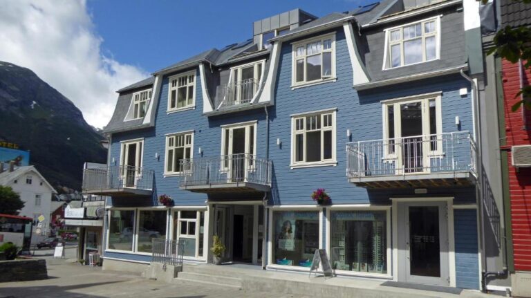
Stavanger is one of southern Norway’s most charming cities, perfect if you enjoy a mix of coast vibes, colorful streets, and great food. The highlight is Gamle Stavanger, the old town, where you can wander through cute cobblestone streets lined with more than 170 white wooden houses from the 18th and 19th centuries.
You can grab a coffee at a cozy café, check out a local gallery, or simply enjoy the peaceful charm of this well-preserved neighborhood. It’s right by the harbor, so you can easily combine your visit with a walk along the waterfront or even a boat ride into the fjord.


Rakssetra is idyllically located as a postcard on the mountainside towards Årheimsfjellet.
The hike to this old farm starts at Oppheim between Stryn and Loen. There is a parking space, which costs around 85kr. From here, you can follow the marked trail to Rakssetra. The hike is around 1,1km with an elevation gain of 262m. It takes around 45 minutes to reach the farm.
You do not always have to go to the highest peaks for great views!

Dalen is a small town in Telemark in Southern Norway with a lot going on if you’re into nature and being outdoors. You can go hiking, rent a canoe, or try some mountain biking if you’re feeling adventurous.
The tourist office in town is actually super helpful. You can swing by to get info on local hikes, where to go fishing, or how to rent bikes. They also help you book things like the Soria Moria sauna (which looks amazing, by the way) or a self-guided tour if you want to see more of the area without joining a big group. It’s one of those places that feels off the radar, but in a good way.


Trollkyrkja, or the “Troll Church,” is a little adventure spot near RV64. It’s a narrow 70-meter-long cave with not one but two waterfalls hidden inside. The echo of the water makes it a bit spooky at first, but it’s worth pushing through.
You’ll hike about 4 km (around 1.5 hours) on a marked trail to reach the caves. There’s a sign where the cave starts, and you’ll definitely want a good flashlight or headlamp for each person.

If you keep going past the entrance, you’ll reach a small marble pool with a waterfall where you can take a quick swim. Then there’s an iron staircase leading down to the second waterfall. Just be ready to get your feet wet!

Borgund Stave Church is one of Norway’s best-preserved medieval wooden churches, located in the village of Borgund. It was built in the 12th century, and still has its original wooden carvings, like dragons, and impressive architecture, which is pretty incredible considering its age.
It’s open to visitors and makes a great stop if you’re interested in a bit of the country’s history, architecture, or just want to see something unique in Southern Norway.

If you’re up for a bit of an adventure, the Lysevegen road, or Lyseveien, is one of those drives you won’t forget, just like the Trollstigen. It twists its way through the mountains between Lysebotn and Sirdal, with 27 sharp hairpin turns and some seriously steep climbs. The views are amazing the whole way, especially from the top near Øygardstølen, where you can stop for a break and take it all in.

Lysevegen is only open in summer, usually from around May to October, depending on the weather. It’s a popular route for people heading to Kjeragbolten, another famous hike in Southern Norway, but even if you’re not planning a hike, the drive itself is worth it. Just take it slow, keep your camera handy, and enjoy the ride.
If you’re arriving in Kristiansand by ferry, or waiting for one to leave beautiful Southern Norway, Odderøya is the perfect place to explore. It’s right by the harbor, so you can walk straight over from the terminal. The island was once a naval base, but is now a beautiful spot for a little walk.


There are well-marked paths that take you past old cannon positions, small beaches, and little forest patches. The ocean views are hard to beat, especially on a sunny day. And be careful, because you might spot a snake or two along the trails.
Did you know that, if you buy or book something through our links, we receive a small commission?
However, you still pay the same and therefore have no extra costs! So a win-win for everyone. This way, we can continue to add even more travel inspiration and tips to this blog for your next adventure. Thanks a lot!
We hope you find our free travel guides and tips useful. If you want, you can support us virtually by ‘buying us a coffee‘.
Every contribution, no matter how small, is greatly appreciated and will help us continue to share our passion with you and grow this blog.
Did you know that, if you buy or book something through our links, we receive a small commission?
However, you still pay the same and therefore have no extra costs! So a win-win for everyone. This way, we can continue to add even more travel inspiration and tips to this blog for your next adventure. Thanks a lot!


")